Sale!
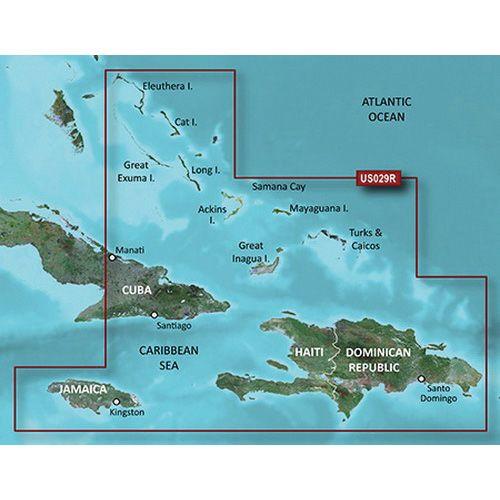
GARMIN HXUS029R BlueChart G3 MicroSD/SD Card Regular On the Water Unparalleled Coastal Chart, Southern The Bahamas | 010-C0730-2
Description
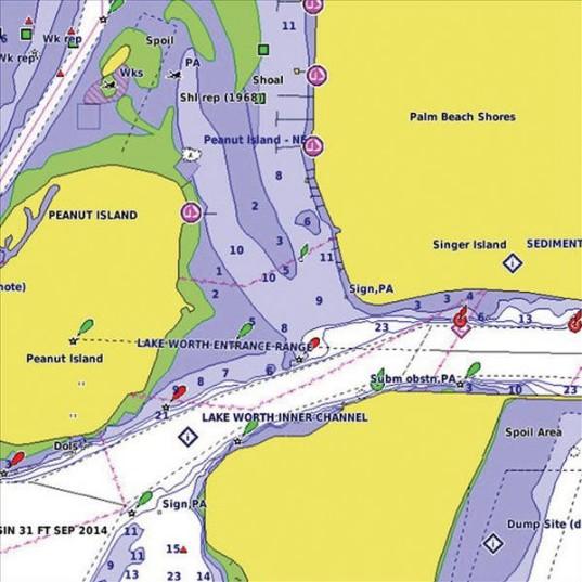
Bluechart g3 coastal charts provide industry leading coverage, clarity and detail with integrated Garmin and Navionics data. Also included is auto guidance1 technology, which uses your desired depth and overhead clearance to calculate routes and provide a suggested path to follow overlaid onto your chart. NOAA raster cartography is also available as a free downloadable feature via the activecaptain app. It gives your chart plotter paper chartlike views of NOAA surveyed areas in which individual points of interest are labeled with corresponding longitude and latitude information.
Additional information
| Weight | 0.04 lbs |
|---|---|
| Dimensions | 6 × 5 × 5 in |
| Manufacturer | |
| Model | 010-C0730-20 |
| UPC | 753759089320 |