Sale!
Description
- Ultra-Wide Coverage – the largest geographical coverage, without compromising on chart quality.
- High-Res Bathy – helps you identify shallow areas, drop-offs, ledges, holes or humps. Now includes compiled and quality-controlled Genesis® detail as part of singular HRB layer.
- Full Featured Vector Charts – making navigation easy by giving you accurate, up-to-date vector chart detail derive from official Hydrographic Office information.
- Custom Depth Shading – set a clear safety depth, maintain a paper-like view or create your own custom shading
- Easy Routing™ – helps you automatically plot the shortest, safest route based on detailed chart data and your personalized vessel information. No subscription required.
- Tides & Currents – shows projections of water level and direction of tides to help plan your day out, cruising, angling or sailing.
- Detailed Marina Port Plans – docking in an unfamiliar port is no problem when you have precise layouts of thousands of marinas, including slip spaces, restricted areas and other valuable navigation information.
- Harbor & Approach Details – unprecedented level of detail. Approach any harbor and inlet with confidence. The perfect conclusion to a long voyage, sailing adventure or an exciting day of fishing.
- Online Updates – keep your chart up to date, with 12 months’ free online updates.
Additional information
| Weight | 0.07 lbs |
|---|---|
| Dimensions | 4 × 6 × 1 in |
| Manufacturer | |
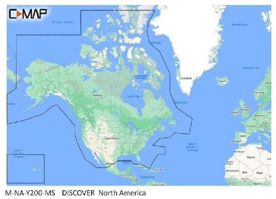
| Model | M-NA-Y200-MS |