Description
EXCLUSIVELY FOR SIMRAD NSX SERIES
Experiencethe X Generation of C-MAP charts – with game-changing Shaded Relief!
C-MAP® DISCOVER™ X offers a fresh, dynamic experience. With the latest vector data, best-in-class Day and Night modes and the most detailed C-MAP High-Res Bathymetry, with an all-new Map Inspector Tool. DISCOVER X also delivers smooth integration with the Simrad® Companion App. Rich features include Custom Depth Shading, Tides & Currents, and subscription-free Autorouting plus 12 months free online updates.
Next Generation Charts
A fresh, dynamic chart experience, making navigation clearer than ever before
Optimised data and new chart presentation to give you the best on-the-water navigation experience
Always see the data you need without clutter, optimised at every zoom level
Best-in-class Day & Night modes. Stay safe and navigate with ease, whatever the weather, whatever the time of day
Smooth App Integration
Link to the Simrad® Companion App – enjoy the same charts and a fully connected experience
Plan trips, review tracks and plot waypoints on the App, then sync straight to your NSX
Access NSX manuals, “How To” guides and much more, directly from the App
The future is connected; with C-MAP & Simrad, you’ll be ready
The Best of C-MAP
The latest chart data, with the detail you need to make the most of your time on the water
Full-Featured Vector Charts – make navigation easy with accurate, up-to-date vector chart detail from official hydrographic office sources
High-Res Bathymetry – identify shallows, drop offs, ledges, holes or humps, with accurate contours down to 1-foot. Includes the best of C-MAP HRB data
Subscription-Free Autorouting – Automatically plot the shortest, safest route based on detailed chart data and your vessel information. With C-MAP, Easy Routing is always subscription free
Custom Depth Shading – set a clear visual safety depth or create your own shading and level-up your fishing to see things your way
Harbor & Approach Details – approach any harbor and inlet with confidence. The perfect conclusion to a long cruise or an exciting day of fishing
New Map Inspector Tool
Quickly access the information you need, with a simple touch of the screen
Tides & Currents – detailed projections of water level and tidal data to help you plan your day out
Detailed Marina Port Plans – docking in an unfamiliar port is no problem when you have precise layouts of thousands of marinas, including slip spaces, restricted areas, and other vital information
12 Months Free Chart Updates
Additional information
| Weight | 0.07 lbs |
|---|---|
| Dimensions | 4 × 6 in |
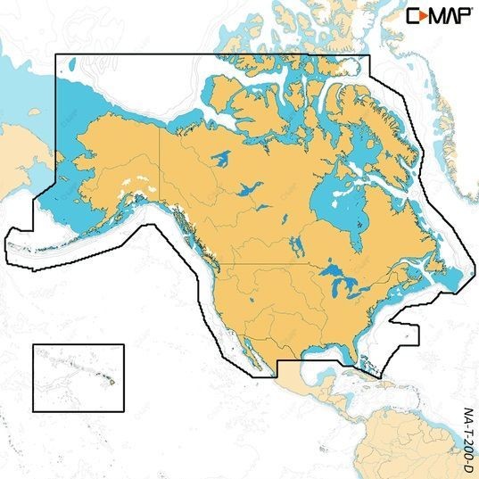
| Model | M-NA-T-200-D-MS |
| Manufacturer | |
| UPC | 9420064127887 |