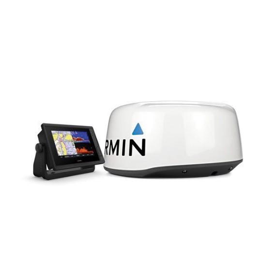
Description
The bright, sunlight readable 7 in intuitive touchscreen chart plotter with enhanced map drawing is easy-to-use in any environment and seamlessly integrates into your Garmin marine system.
Additional information
| Weight | 42 lbs |
|---|---|
| Item Name | Chartplotter with GMR 18 HD+ Radome |
| Manufacturer | |
| Model | 010-02320-51 |
| Type | Bundle |
| Series | 742xs Plus |
| Display Resolution | 800 x 480 pixel |
| Card Type | (2) 32 GB Maximum MicroSD Card |
| Cartography | BlueChart G3 and LakeVu G3 |
| Connection Interface | NMEA 2000 Compatible, 8-Pin (Blue) Transducer Pin Numbers, (1) Differential NMEA 0183 Input Port, (1) Differential NMEA 0183 Output Port, (1) BNC Video Input Port, Wireless Connectivity, J1939 Compatible |
| Dimensions | 8.8 in W x 2.1 in D x 5.6 in H |
| Mount Type | Bail/Flush |
| Diagonal Screen Size | 7 in |
| Voltage Rating | 10 to 32 VDC |
| Display Size | 6.1 in W x 3.4 in H |
| GPS | 10 Hz Internal High-Sensitivity GPS/Glonass |
| Temperature Rating | 5 to 131 deg F |
| Waterproof Rating | IPX7 |
| Frequency | 50 kHz Low/77 kHz Medium/200 kHz High CHIRP Traditional; 260/455/800 kHz ClearVu (Dependent on Transducer) |