Description
EXCLUSIVELY FOR SIMRAD NSX SERIES
Experiencethe X Generation of C-MAP charts – with game-changing Shaded Relief!
C-MAP® REVEAL™ X offers a fresh, dynamic experience. All the great features from DISCOVER X, including Map Inspector Tool, and more – bring the world around you to life with Shaded Relief and feel connected to your surroundings with Satellite Overlay. REVEAL X charts also deliver smooth integration with the Simrad® Companion App and come with 12 months of free online updates.
Next Generation Charts
A fresh, dynamic chart experience, making navigation clearer than ever before
Optimized data and new chart presentation to give you the best on-the-water navigation experience
Always see the data you need without the clutter, optimized at every zoom level
Best-in-class Day & Night modes. Stay safe and navigate with ease, whatever the weather, whatever the time of day
Smooth App Integration
Link to the Simrad® Companion App – enjoy the same charts and a fully connected experience
Plan trips, review tracks, and plot waypoints on the App, then sync straight to your NSX
Access NSX manuals, “How To” guides, and much more, directly from the App
The future is connected; with C-MAP & Simrad, you’ll be ready
Map Inspector Tool
Quickly access the information you need, with a simple touch of the screen
Tides & Currents – detailed projections of water level and tidal data to help you plan your day out
Detailed Marina Port Plans – docking in an unfamiliar port is no problem when you have precise layouts of thousands of marinas, including slip spaces, restricted areas, and other vital information
Features:
Smooth App Integration
Map Inspector Tool
Full-Featured Vector Charts
High-Resolution Bathymetry
Custom Depth Shading
Best-in-Class Day & Night Modes
Tides & Currents
Detailed Marina & Port Plans
Harbor & Approach Details
Subscription-Free Autorouting
12 Months Free, Easy Chart Updates
Connected Experience – Future-Proof
Shaded Relief REVEAL Layer
Satellite Imagery
Exclusively for REVEAL X
Shaded Relief
Bring the world around you to life with 3D rendered land and underwater elevation, including areas of ultra-high-resolution – a game-changer for anglers and divers
Satellite Imagery
Feel better connected to your surroundings when you find yourself in an unfamiliar place
Additional information
| Weight | 0.07 lbs |
|---|---|
| Dimensions | 4 × 6 in |
| UPC | 9420064129089 |
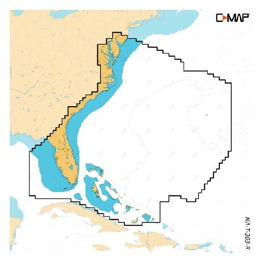
| Model | M-NA-T-203-R-MS |
| Manufacturer |